Wednesday, August 15, 2012

Badboot


Source: Architecturetoday.co.uk

One of the world’s biggest, floating open air swimming pool named Badboot will open on the Eilandje in Antwerp (Antwerp Docklands) in mid-August 2012. The floating structure, with a total length of 120 metres, can accommodate 600 people and consists of a swim basin, two event venues, several floors and a restaurant with a lounge terrace.
Designed by architect Pieter Peerlings together with partner Silvia Mertens of Sculp(IT) Architects , the project has been conceived jointly by Philip De Prest, managing director of V-Zit bvba, with the City of Antwerp.
Whilst outdoor, floating swimming pools are found in Berlin, Paris and Copenhagen, the Badboot differs from all other European precedents by being significantly larger with a 40 metre  pool. The Badboot can also be moved around the city to other sites and will be open throughout the year. In winter, however, the pool will function as an ice rink and venue for other winter sporting activities such as curling.

John Rocque

Somebody posted an image of an old map of the Liffey on facebook today. I was sure it had been used on an old Irish bank note (pre euro) and did some searching online. It turns out that my memory is to be trusted, it was on the back of the ten pound note and the image is taken from the 1756 map of Dublin by John Rocque. What interests me about the image is the amount of ships and boats on the Liffey, hard to imagine now that it once was such a bustling transport hub 250 years ago.


Source: Wikipedia
John Rocque (1709–1762) was a surveyor and cartographer.Rocque is now mainly remembered for his map of London. He began work on this in 1737 and it was published in 24 printed sheets in 1747. It was by far the most detailed map of London published up to that time, and remains an important historical resource.
The map of London and his other maps brought him an appointment as cartographer to the Prince of Wales in 1751. 
His 1756 map of Dublin featured on an Irish Ten Pond banknote. The Area around Dublin city is covered on 4 maps. They extended as far as Skerries and Cardy Rocks to the North, Carton House to the west, Blessington to the south west,and Enniskerry to the south.

Sunday, August 12, 2012

Barking Bathhouse


Source: www.createlondon.org
Axe Street, IG11 7LX, Barking & Dagenham

CREATE has commissioned Something & Son to design and build a unique new space, the Barking Bathhouse, that draws on innovative health, beauty and design practices to bring about a little bit of happiness and relaxation this summer.
Something & Son is the design practice behind the hugely successful FARM:shop in Dalston, in which a fully functioning farm has been created in a disused shop. Its approach for the Bathhouse is rooted in a long history of British inquisitiveness and experimentation, and reflects its passion for social enterprise, sustainability, engineering and art.
The Bathhouse revives the spirit of Barking’s former Bathhouse, which, before closing in 1986 after 87 years of operation, catered for the health of thousands of local people and even hosted events, dinners and dances until the 1960s. The 6,000-square-foot new structure is inspired by both 20th-century working men’s bathhouses and ultra-modern spas, and combines modern spa technologies with functional design that draws on Barking’s industrial heritage, the black-stained timber farm buildings of Essex and the wooden beach huts of Kent. Its raw aesthetic challenges traditional notions of luxury whilst creating a blissful space to relax, and its pod-based design, which was prefabricated and assembled on site, was planned with the future in mind, so that after it closes, the pods can be relocated individually or together for continued use by the local community.
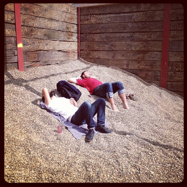
For the ultimate in indulgence, the Bathhouse combines a spa with a bar. A series of massage and treatment rooms lead to a traditional sauna and a cold room lined with ice blocks, bringing traditional bathhouse rituals into the experience. Massages, body treatments, manicures and pedicures are all offered, and Something & Son has worked with local beauticians and gardeners to develop natural treatments that use produce from local allotments. In the relaxation area, spa visitors will be able to socialise and sunbathe on loungers in seaside-inspired pebble bays under an open roof, whilst in the bar, they can sip healthy cocktails and smoothies under a canopy of cucumber vines that also provide the raw materials for treatments next door. Shingle dunes provide the perfect space to relax and unwind between treatments.
The Bathhouse also runs a varied events programme – from philosophical talks to chocolate-making workshops, plus laughter yoga, clowning workshops and comedy nights, its ethos is to cultivate happiness and wellbeing.

High Line Art


Tonoaki Suzuki


Maurizio Cattelan & Pierpaolo Ferrari

David Shrigley

Sarah Sze


Source: www.highline.org

Presented by Friends of the High Line, High Line Art commissions and produces public art projects that take place on and around the High Line. Founded in 2009, High Line Art presents a wide array of artworks including site-specific commissions, exhibitions, performances, video programs and a series of billboard interventions. High Line Art invites artists to think of creative ways to engage with the uniqueness of the architecture and design of the High Line and to foster a productive dialogue with the surrounding neighborhood and urban landscape.


High Line Art is curated by Cecilia Alemani, the Donald R. Mullen, Jr. Curator and Director of High Line Art at Friends of the High Line.

The High Line


Source: www.thehighline.org

The High Line is a public park built on an historic freight rail line elevated above the streets on Manhattan’s West Side. It is owned by the City of New York, and maintained and operated by Friends of the High Line. Founded in 1999 by community residents, Friends of the High Line fought for the High Line’s preservation and transformation at a time when the historic structure was under the threat of demolition. It is now the non-profit conservancy working with the New York City Department of Parks & Recreation to make sure the High Line is maintained as an extraordinary public space for all visitors to enjoy. In addition to overseeing maintenance, operations, and public programming for the park, Friends of the High Line works to raise the essential private funds to support more than 90 percent of the park’s annual operating budget, and to advocate for the preservation and transformation of the High Line at the Rail Yards, the third and final section of the historic structure, which runs between West 30th and West 34th Streets.

The High Line is located on Manhattan's West Side. It runs from Gansevoort Street in the Meatpacking District to West 34th Street, between 10th & 11th Avenues. The first section of the High Line opened on June 9, 2009. It runs from Gansevoort Street to West 20th Street. The second section, which runs between West 20th and West 30th Streets, opened June 8, 2011.

The New York City Waterfalls


Source:Wikipedia

New York City Waterfalls was a public art project by artist Olafur Eliasson, in collaboration with the Public Art Fund, consisting of four man-made waterfalls placed around New York City along the East River. At $15.5 million, it was the most expensive public arts project since Christo and Jeanne-Claude's installation of The Gates in Central Park. The waterfalls officially began flowing on June 26, 2008. They ran from 7 am to 10 pm (under illumination after sunset), until October 13, 2008.
The sites chosen for the four waterfalls were Pier 35 in Manhattan, beneath the Brooklyn Bridge in DUMBO, Brooklyn, between piers 4 and 5 — also in Brooklyn — and Governors Island.
Work on erecting the four support scaffolds began in mid-March, 2008. Once completed, the scaffolding would total 64,000 square feet (5,900 m2) and weigh 270 tons. Eliasson has said that the scaffolds themselves were designed to blend in with their urban surroundings, but that he purposely did not try to conceal them, explaining he "want[s] people to know that this is both a natural phenomenon and a cultural one.”
Construction involved the work of 108 different people, including two environmental consultants. The installation was designed to be ecologically-friendly. Some example of this are energy efficient LED lighting, energy purchased from renewable sources and the filters used to keep aquatic life from taking a ride up-and-over the waterfall. When the project closed the materials were made available for re-use in a future project.
The over $15 million dollar project had no city funding and was paid for entirely by private organizations, business and donors. Mayor Bloomberg's company, Bloomberg LP, donated $13.5 million. With estimates that the waterfalls could generate up to $55 million for the local economies, the Lower Manhattan Development Corporation gave $2 million to the effort.

Thursday, August 9, 2012

Green River


“Conversation between Olafur Eliasson and Hans Ulrich Obrist.”  

Hans Ulrich Obrist: We could start by talking about your Green River series, in 
which you completely changed the look of certain cities by colouring their rivers 
green. A good example was Stockholm, where you had a residency. How did people in Stockholm react? 

Olafur Eliasson: At the time I was working on a smaller project, but very quickly the idea of colouring downtown Stockholm became something I just had to do. I bought the pigment in Germany and came back through customs with a real feeling of suspense and excitement; after all, I had enough colorant with me to dye the whole centre of the city. This wasn't an official project; I had to work really fast, so I'd got the planning down pat together with the current and the turbulence in the river, and one Friday at half past one there I was on the bridge with Emile and a bag full of red powder and people starting to stare at us. I hesitated for a moment then emptied the bag out over the parapet and the wind whipped up this enormous red cloud. I could literally feel people in cars slowing down, the cars went all quiet. And there was this cloud, floating over the river like a layer of gas. When it came in contact with the water, all of a sudden the river turned green, it was like a shock wave. There was a crowded bus ten metres a way and everybody was staring at the water. I told Emile we should maybe move on, as if everything was perfectly normal, then I carefully put the 
bag in a trashcan, as if colouring the centre of Stockholm was the kind of thing I did every day. I went down to the studio residency and when I came out again my heart started jumping up and down like mad: the whole length of the river was completely green and all these people had stopped to look at it. Next day it was all over the front page of the papers: "The river turned green". The colorant was absolutely harmless and there was no pollution whatsoever. 

HUO: So the idea was to make the city visible for its inhabitants, who no longer take any notice of the way it works or what's special about it. What you did was aimed at challenging their perception of their environment as something changeless and reassuring. 

OE: Right. I wanted to get a fix on how the river is perceived in the city. Is it 
something dynamic or static? Something real or just a representation? I wanted to make it present again, get people to notice its movement and turbulence. For a few minutes there it was "hyperreal". In some respects the history of cities is the history of how they're represented and most of the time this is done by accentuating the classical, monumental structures that suggest power. The way we experience public spaces is more to do with the way representation and iconography influence our senses and our habits of seeing. A lot of people see urban space as an external image they have no connection with, not even physically.